METRO DETROIT — The temperatures are at an all-time high as the summer kicks off and the boating season is officially in full swing.
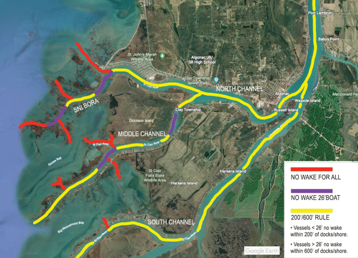
With that being said, the 2022 no wake zone map should be an essential guide for boaters, not only for the safety of your boat with the declining water levels, but the safety of your wallet, as well.
Boaters should be aware that a highly ticketed area is near Brown’s Bar in the Middle Channel. The area near Brown’s Bar is a no-wake zone for vessels over 26 feet in length. The Middle Channel operates under the 200/600-foot rule, with the exception of Brown’s Bar and a small stretch near the beginning of the Middle Channel by the residential areas.
“Even though the water levels are receding, all the houses and marshes are susceptible to being waked out in that area,” said Petty Officer 2nd Class Samuel Zarraonandia, of the United States Coast Guard Station St. Clair Shores.
The 200/600-foot rule states that vessels over 26 feet must stay 600 feet from shore, while vessels less than 26 feet must stay at least 200 feet from shore.
The entirety of the South Channel is classified under the 200/600-foot rule.
In the North Channel, from the Sni Bora out to Lake St. Clair is a clearly marked no-wake zone. The area is highly trafficked, so boaters should remain cautious and aware of the no-wake zone markers.
The decreasing water levels have allowed islands in both the Middle Channel and North Channel to reappear. Lower levels have also made Muscamoot Bay and Fisher Bay areas to proceed with caution in.
“With how low the water has been, those are areas that definitely need to be taken with caution,” Zarraonandia said.
Interested boaters can visit claytownship.org for more information about no-wake zones for the 2022 season. Wake zone maps of southern St. Clair County are available, as well.
 Publication select ▼


