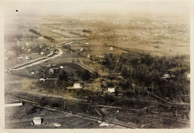
This 1923 aerial view of Vinsetta Boulevard shows the few houses in the area at that time.
Photo provided by the Detroit Public Library
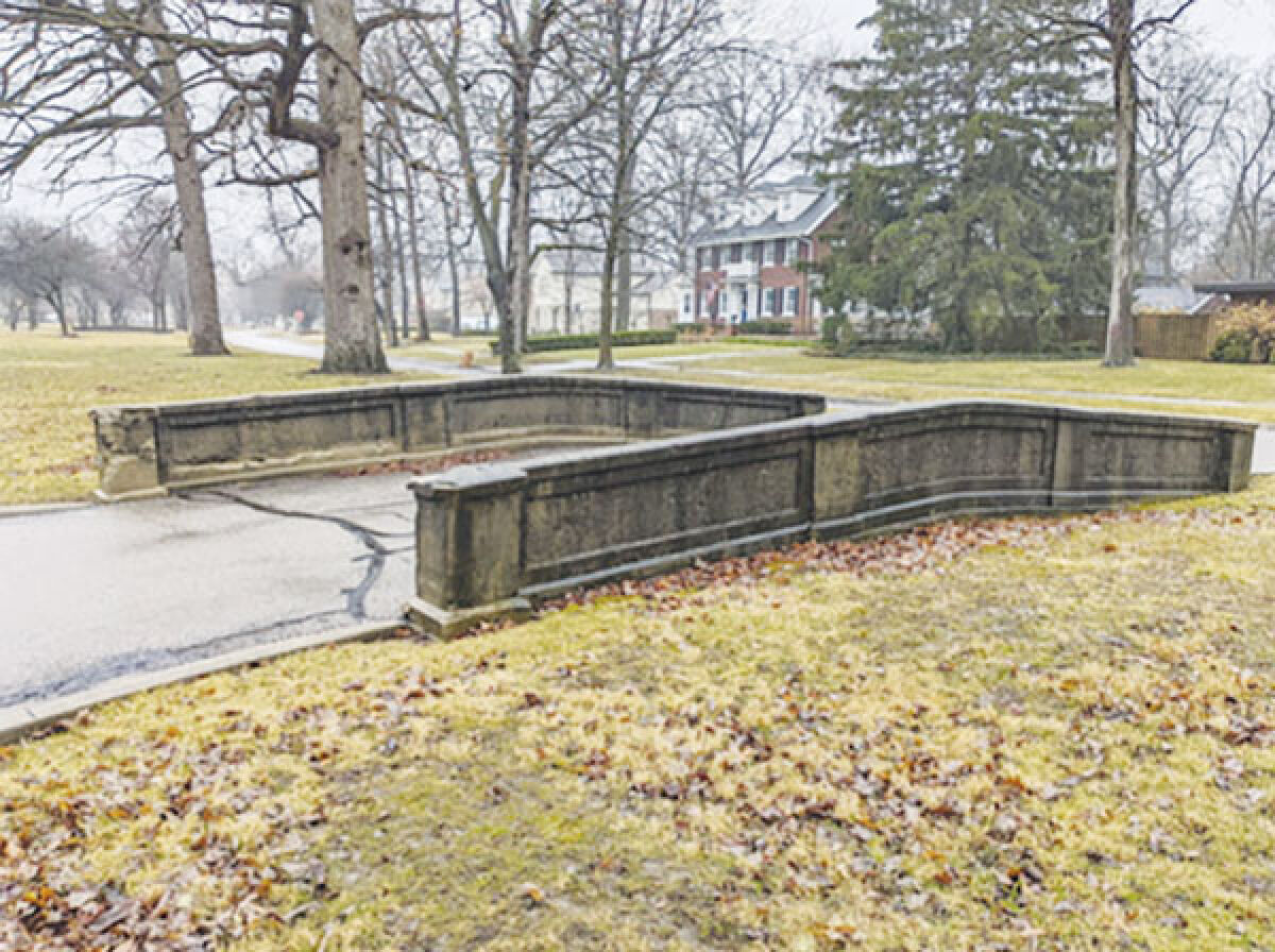
ROYAL OAK — Vinsetta Boulevard, a street with a dense history, is lined with historic homes and a few significant bridges.
Four bridges and some green space on Vinsetta Boulevard were considered for historic preservation at the Feb. 29 City Commission meeting and received the commission’s unanimous approval.
The area was first drawn up as “Vinsetta Park” and became official in 1915, when the Vinsetta Land Co. came to fruition, consisting of 150 acres of land.
Following a year of construction, the June 3, 1916, edition of the Detroit News announced the “Opening Day” of Vinsetta Park, according to the Vinsetta Bridges Historic District report.
According to the report, the bridges are a reminder of Royal Oak’s rural past.
“There is an undeniable romance to the story of the Vinsetta Bridges,” it said. “The one way bridges, the leafy suburbs, the winding country road. Born of desire to have urban comforts close to your home in the country, the vision of the Vinsetta Land Company must have been quite compelling.”
The historic preservation includes “2.90 acres of property that run along the Vinsetta boulevard median from the Lawndale turnaround to the turnaround just before 12 Mile Road,” as stated in the proposal document.
The four bridges, as well as the open space between them, will be preserved, and are entirely owned by the city of Royal Oak.
In 2023, the Historic District Study Committee did a study examining the green space and the bridges to abide by state and local law. Following this, it was recommended to request an ordinance designating the area as a historic district.
Designating an area as a local historic district provides legal protection for its historic resources, according to the Michigan Economic Development Corporation website.
Tammis Donaldson, chairperson of the Historic District Study Committee, said preserving this area will help to protect the bridges from demolition.
“That doesn’t mean that demolition can’t happen; it can,” she said. “But it’s got to go through a review process, so it gives it protection to keep the bridges.”
The idea was first presented to the Planning Commission, which tweaked and finalized the proposal for the City Commission. There was also a public hearing held by the Planning Commission in regard to this topic
The green space up for historic designation is located above several utilities that caused concern among city departments, according to the proposed document.
“The utilities consist of: SOCWA’s 30 inch transmission main; several county sewers; part of the city’s 8 inch water main and multiple city storm sewer crossings that all run under the green space proposed to be historically designated,” according to the document.
If not addressed properly, city departments would need to go through the Historic District Commission to request maintenance of the utilities or tree removal or replacement within the green space area.
It was determined by the City Attorney’s Office that the historic district proposal should also include a solution to this, exempting the city from needing to present a certificate of appropriateness from the HDC if work was needed in the area.
“What our office did was suggest a resolution or an ordinance that would still designate the area as historic, including the green space, but carve out an exception that if a utility owner needed to go in and repair or replace, they wouldn’t need to obtain a certificate of appropriateness from the Historic District Commission,” City Attorney Niccolas Grochowski said.
Commissioners Brandon Kolo and Melanie Macey were hesitant to approve the green space as historic, questioning why this green space should be preserved and not others in Royal Oak.
Patrick Andras, member of the Royal Oak Historical Commission, was presenting the information to the commission, and said that this green space has more historic significance than others in the city.
“This particular green space goes back to the original design and plat of the entire subdivision, it was a part of the garden cities, to make it curved roads and open spaces,” he said. “That feeling of the ’20s, it was allowing people to come from a gridlike system in, let’s say, the city of Detroit, to move out into an area that is more open.”
This “feeling of the ’20s” is why Andras said this plot of land should be preserved, as it helps create the feeling of the era. Preserving this particular open space will prevent changes in the future, such as a bike path.
Following the designation of the area as historic, Donaldson is hoping for a grant to be awarded to the Historic District Study Committee. The grant would go toward a historic study report to find out what the condition the bridges are in currently, and how to repair them.
Donaldson said that the grant will be asked for in the future. She is unsure of an exact date of when the grant will be requested.
“The past is an important thing to preserve,” she said. “Otherwise, everything is the same and new. So this gives us a variety of what we see in the environment. I believe in the positive part of historic preservation.”
 Publication select ▼