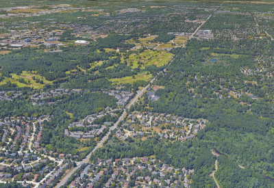
Officials are in the process of a four-year study of the Adams Road corridor, from Hamlin Road to Walton Boulevard.
Photo provided by the Road Commision for Oakland County
ROCHESTER HILLS — The first phase of a four-year study on the Adams Road corridor is now complete, and officials are looking to the future for more answers.
The Road Commission for Oakland County’s Craig Bryson said the two-lane corridor, which provides access to Oakland University and Meadow Brook Hall, has been a challenge for decades.
“It’s a congested corridor,” Bryson said. “You have a major university there, in the middle of a residential community, with shopping corridors at the north end of the corridor there, so there have been decades of discussion of doing something with the corridor. But there have been debates about it. Some people want to do something and others don’t.”
In 2021, the city of Rochester Hills, the Road Commission for Oakland County and Oakland University joined forces to conduct a study to determine the future of the Adams Road corridor, from Hamlin Road to Walton Boulevard. The project involves the preparation and development of a planning and environmental linkage study, which is currently underway, and an environmental assessment for the approximately 2.22-mile area.
“Adams Road has continually come up during the city’s and county’s planning and public outreach efforts as one of the roads in Rochester Hills that needs improvements to help alleviate safety, traffic delay and congestion concerns. The corridor is clearly not safe for pedestrians and bicyclists,” Rochester Hills Planning and Economic Development Director Sara Roediger said. “With the joint effort of the county, OU and the city, resulting in a grant to study the corridor, we felt it was time to take a deep dive to see what options there are for improvements.”
Over the course of the four-year study, Bryson said, members of the public and stakeholders will shape future plans for the corridor, which he noted could include making improvements or doing nothing.
“It could be that the outcome of this study is to recommend that no action is taken, or that there be small tweaks along the corridor. It could also be that the study recommends widening the road or something different. There is no forgone conclusion here, and there is no predetermined outcome,” he said.
To date, community involvement has included a public workshop, 11 stakeholder meetings, an online survey and a visioning results summary, with a website for people to follow the progress of each phase at https://mksk.mysocialpinpoint.com/visioningadamsroad.
“The whole point of doing the study is to find out what is possible, what the community wants and what potential impacts a variety of options would have on the community,” Bryson said. “We want to make sure that if anything goes forward, it’s reflective of the desires of the larger community.”
Roediger said phase one of the study went “really well” and engaged “a wide variety of people.”
Around 165 people attended the first public workshop — held in October — which introduced the study and asked for feedback from the public and various stakeholders. The majority of public comments from the workshop, according to officials, centered around improving safety and congestion, preserving historical and natural features, and keeping the corridor as it is today.
In November, the project team also met with a number of key stakeholder groups — including homeowners associations, Oakland University officials, city and university police and fire departments, various city committees, historic preservation groups, churches and the Rochester Community Schools district — to discuss their concerns and ideas. The majority of comments, officials said, suggested that widening the road would not make the road less congested or safer, since more traffic would be attracted to the area and use it; that the hills and nature, especially mature trees, along the corridor should be preserved; and that historical elements along the corridor should be preserved. Many stakeholder groups suggested that lowering the speed limit and adding traffic calming tools — like roundabouts, left hand turn lanes and re-timing traffic lights — would help make the corridor safer. There was also a desire to improve pedestrian, bike, scooter and other modes of travel along Adams Road — including connecting to the Clinton River Trail — and to ensure that the Clinton River bridge is designed to accommodate stormwater runoff, pedestrians and bicyclists.
“The team developed an all-inclusive phase one engagement summary that highlights the main takeaways. Clearly people love the look and feel of Adams Road, and that is made up primarily of both the natural and historic features found along the corridor. Any improvements that may be made in the future will need to respect those cherished features as much as possible,” Roediger said.
A complete summary of phase one results can be found online at https://mksk.mysocialpinpoint.com/visioningadamsroad/visioning-adams-road-page-1.
Despite the completion of phase one, Bryson said there are “no significant findings yet.”
“This is just the introductory element to explain to people what we are doing, how we are doing it, how it will take place, and begin to receive input,” he said. “The project process, obviously, continues from here, and we are not yet anywhere near the point of looking at what the alternatives are at this point, but that will be coming up.”
Phase two, set to start in the spring, will include additional upcoming public and stakeholder input opportunities. A second public workshop, focusing on reviewing the project’s purpose and needs, with input from the public, will be held in May, followed by a third public meeting to review the alternatives in the winter of 2024.
The final steps of the study involve presenting the plan during a fourth public workshop in the winter of 2025, followed by a formal public hearing of the environmental assessment in the summer of 2025.
“We’re very much looking forward to seeing where this process takes us,” Roediger said.
The study is funded by a $2 million federal Better Utilizing Investment to Leverage Development, or BUILD, grant that was awarded in 2020, with a study start date of 2022. The Road Commission and the city of Rochester Hills are splitting the required local match of $500,000 to complete the study.
For more information, visit https://mksk.mysocialpinpoint.com/visioningadam sroad.
 Publication select ▼


